In shortThe date on the file is 11 December 1987, the category is cultural and the grounds are criterion (v); Xochimilco does not hold the listing on its own, because property ID 412 was registered jointly with the historic centre of Mexico City. The listed area takes in fourteen original villages beside the canals and chinampas, and the surrounding Xochimilco and San Gregorio Atlapulco lake system is a protected wetland of 26.57 km2, or 2,657 hectares.
11 December 1987Date of inscription
412UNESCO property ID
2,657 haProtected wetland area
14Original villages inside
What the Xochimilco UNESCO World Heritage site listing actually covers
The status is cultural, and it is shared. Xochimilco entered the list on 11 December 1987 under criterion (v), in the same file as the historic centre of Mexico City, registered as property ID 412. One inscription covers two very different components: colonial streets in the middle of the capital, and a working water landscape about 28 km to the south.
Inside the borough, the protected area is not just the tourist stretch of water. It covers fourteen original villages that sit alongside the canals and the chinampas, plus the farmland itself. Separately from the UNESCO file, the Xochimilco and San Gregorio Atlapulco lake system holds formal status as a protected wetland, with a reported area of 26.57 km2 (2,657 hectares), and roughly 184 km of navigable channels run through the plots.
No official figure in hectares is published for the Xochimilco component of the World Heritage property itself, so treat any single area number you see for "the UNESCO site" with caution. The wetland figure above refers to the lake system designation, which is a separate instrument.
- Inscribed: 11 December 1987
- Type: cultural site, criterion (v)
- File shared: registered as property ID 412, with the capital's historic centre as the other component
- Inside the protected area: fourteen original villages, the canals and the chinampas
- Lake system designation: 26.57 km2 (2,657 hectares) of protected wetland
Why is Xochimilco a World Heritage site
Criterion (v) is the one used for landscapes shaped by human use that are still in use, and that is the whole case here. There is no single ruin or cathedral at the centre of the listing. What is listed is a method of farming: chinampas, plots raised out of a shallow lake by hand between roughly the 14th and 16th centuries, squared off by water on every side, and still planted. The borough's own kitchens still cook with what comes off them.
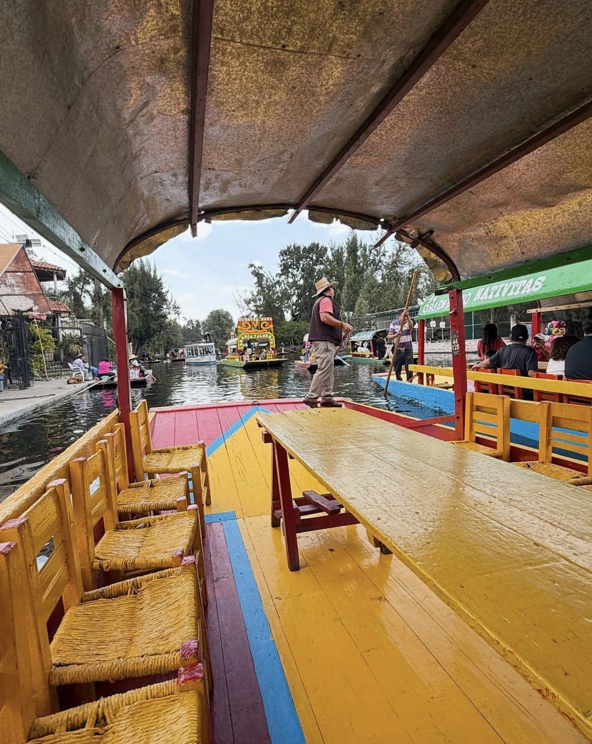
The channels you travel along are the by-product of that method. Each one is the gap left between two plots, which is why they are narrow, straight in long runs and barely wider than one flat-bottomed boat. The old lakes around them were drained as the city grew; the farmed section survived because it was farmed.
The urban half of the same file is the historic centre of Mexico City. Xochimilco's own centre, made up of 17 original barrios, each with its own history, is where the town meets the water: give it an hour and look at where the water starts and stops.
What puts the protected area under pressure
A listed landscape that depends on people keeping it means the risks are mostly slow ones. The city keeps growing towards the chinampa belt, so built edges press on plots that used to be surrounded by water. Water quality in the channels is the second concern, because the canals are fed and flushed by a system that no longer behaves like a lake.
Then there is the farming itself. Plots that stop being cultivated silt up, lose their banks and stop being chinampas in any useful sense, and the listing rests on cultivation continuing rather than on the shape of the land. The clearest single indicator is the axolotl: conservation work in the protected area is built around this amphibian, the emblematic species of Mexico City, and its habitat is the same water that carries the boats.
Public conservation space exists inside the borough. Some of that pressure is answered on public land at Periférico Oriente #1, Col. Ciénega Grande, where 165 hectares of canals, chinampas and axolotl habitat are held as the Parque Ecológico de Xochimilco and managed rather than farmed. This site covers it in detail on the ecological park page, and the axolotl page sets out where conservation work on the species is concentrated.
Markets, a chinampa and an axolotl sanctuary
This 3.5-hour outing puts you on a working chinampa and at an axolotl sanctuary, which is where the farming and the conservation behind the listing are actually visible.
★ 5.0/5 · 12 reviews
Where you can see the protected zone from the water
The docks are not interchangeable, and this is the point where that matters most. According to the official borough tourism page, the embarcaderos whose routes run through the protected natural zone of the canals are Fernando Celada, Cuemanco and Puente de Urrutia. On those ecological routes you can spot migratory and endemic birds. The traditional landings on the Nativitas side, where the music and the food boats concentrate, follow other water.
Hours decide how much of the zone you actually reach. There is no lighting along the channels, so boats generally work between about 8:00 and 17:00 even where a dock stays open later, and being on the water by mid-morning is the sensible order. Only some embarcaderos publish a timetable on the city portal, so check on the day.
Fernando Celada is the one of the three you can reach without a car: the walk from the Xochimilco or Francisco Goitia light rail stations runs to about ten minutes, and roughly 140 boats work out of it. Cuemanco sits across the road from the Mercado de Plantas y Flores de Cuemanco, at Canal Nacional 2000, Coapa, 16036, which opens daily 8:00 to 16:00.
| Embarcadero | Routes | Published hours | Getting there |
|---|
| Fernando Celada | Through the protected natural zone; migratory and endemic birds | Monday to Friday 8 a.m. to 6 p.m., Saturday and Sunday 8 a.m. to 10 p.m.; occasional night rides called Lunadas 8 p.m. to 10 p.m., announced only when available | About ten minutes on foot from the Xochimilco or Francisco Goitia light rail stations; home base for about 140 boats |
|---|
| Cuemanco | Through the protected natural zone; migratory and endemic birds | Not published on the city portal; check on the day | Beside the Cuemanco plant and flower market, Canal Nacional 2000, Coapa, 16036 |
|---|
| Puente de Urrutia | Through the protected natural zone; migratory and endemic birds | Not published on the city portal; check on the day | One of the borough's ten authorised landings, open every day of the year |
|---|
Which tour to choose for this stretch of canal
Pick an early or nature-leaning route and skip the loud water. The protected zone gives you birds, plot edges, willow lines and quiet, and all of that is best before the day fills up. Two tours on this site fit that brief on their own.
The Sunrise Kayak Tour in Xochimilco runs 5 hours, from 480 pesos, rated 4.6 ★ (95 reviews). It includes kayak, vest and individual paddle plus traveller insurance, with breakfast (coffee, fruit, bread and a main course) and round-trip transport in an air-conditioned vehicle as selectable options. The meeting point is in front of the yellow church, where staff wear blue and pink vests. Paddling puts you low on the water at the hour the birdlife is active, which is the closest a visitor gets to the landscape the listing describes.
If you would rather stand on the farmland than paddle past it, the Guacamole a Tasty Adventure Through Xochimilco Markets and Canals runs 3.5 hours, from 1,900 pesos, rated 5.0 ★ (12 reviews). It starts with coffee or tea and sweet bread or a tamal, takes a bicitaxi from the markets down to the pier, and includes a traditional chinampa with an axolotl sanctuary, plus the ingredients for a taco placero and hibiscus flower water along the boat trip. Note that the kayak tour does not list an English-speaking guide among its inclusions; the markets tour is hosted in English.
Questions people ask
Is the UNESCO listing only about the canals?
No. The inscription is shared with the historic centre of Mexico City as a single property, ID 412, and within the borough the protected area takes in fourteen original villages as well as the canals and chinampas. The borough's own centre adds another layer, since it is made up of 17 original barrios.
Is the protected area the same thing as the protected wetland?
They are two separate designations covering overlapping ground. The UNESCO listing dated 11 December 1987 is cultural, under criterion (v). The Xochimilco and San Gregorio Atlapulco lake system carries wetland protection with a reported area of 26.57 km2, or 2,657 hectares, and that is where conservation work on the axolotl is concentrated.
Can I reach the protected zone on a short ride from the busiest docks?
Not reliably. The borough lists Fernando Celada, Cuemanco and Puente de Urrutia as the launches whose routes run through the protected natural zone, while the traditional Nativitas-side landings follow other water. Choose the route and the departure point for the zone you want to see, and allow for the fact that boats generally work between about 8:00 and 17:00.
Will I see axolotls in the canals?
Treat a wild sighting as unlikely; the species is the focus of conservation work precisely because its habitat is under pressure. The markets and canals tour on this site includes a visit to a traditional chinampa with an axolotl sanctuary, and the Parque Ecológico de Xochimilco protects axolotl habitat across some 165 hectares at Periférico Oriente #1.
What is the best time of year to see the ecological routes?
There is no closed season to work around, because the ten authorised embarcaderos keep working through all 365 days of the year. Rain is the variable worth planning around: the borough put out a bulletin on reinforcing measures for the rains dated 3 June, a fair marker for favouring a morning departure through the summer. On the ecological routes, migratory as well as endemic birds can be spotted.
Read also