In shortXochimilco history runs from the Xochimilca, who farmed the shallow southern lake by raising plots out of it, through absorption into the Mexica world and the canoe trade that supplied Tenochtitlan, to a colonial town of 17 barrios and fourteen surviving villages. The lakes were drained for the growing city; roughly 184 km of canals remain, inscribed by UNESCO on 11 December 1987.
14th-16th centurieschinampa building period
11 December 1987UNESCO inscription date
184 kmnavigable canals remaining
17barrios in the historic centre
Who the Xochimilca people were, and the first lake farms
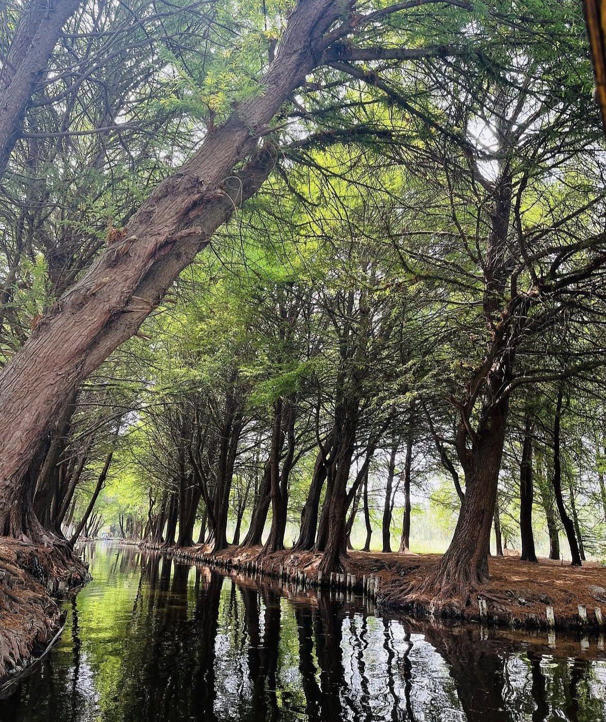
The Xochimilca settled the southern, shallowest end of the valley's lake system, and rather than hunting for dry ground they made farmland out of the water. The method was slow and repetitive. Stake out a rectangle in the shallows. Pile up lake mud, weed and soil until the surface stands clear of the water. Plant willows along the edges so the roots bind the sides, then start again on the plot next door. The borough dates that construction across the 14th, 15th and 16th centuries, and the same raised plots are planted today.
The layout follows from the water. Every plot has a channel on each side, so the field was reached, measured and harvested by boat, and the pattern you see from a trajinera is the shape of a working field system. The chinampas page on this site covers how the plots are built and where you can stand on one.
Xochimilco in Aztec history: canoes north to Tenochtitlan
Tenochtitlan stood on an island in the same chain of lakes, and as it grew the Xochimilca lands came under Mexica control. What the city wanted was output. Vegetables, maize and flowers moved north by canoe from the chinampa belt to the island markets, and the 28 km that now separate the canals from central Mexico City were water for much of that run.
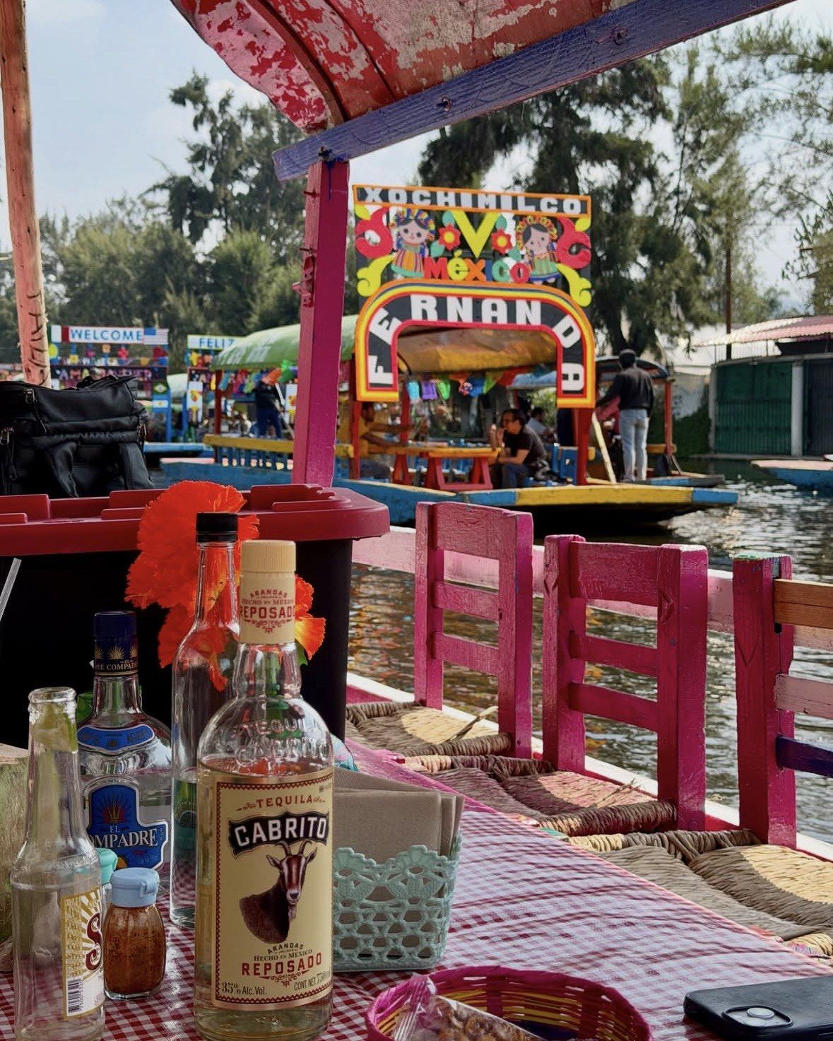
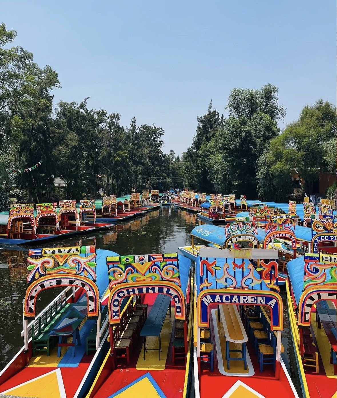
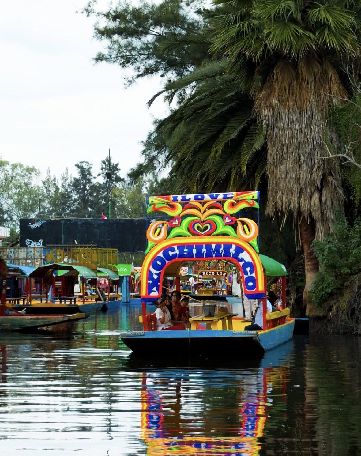
The boats carry the continuity. Flat bottom, shallow draught, poled along narrow channels: the painted trajinera that takes visitors out today descends from working craft, and the channels it follows still trace plot lines drawn 600 years ago. The borough's cuisine runs on produce from those chinampas, so the vegetables in a Xochimilco kitchen are grown on the same raised fields you pass on the ride.
The colonial town, its church and its barrios
Spanish rule reorganised the lake towns around churches. The dated marker of that change here is San Bernardino de Siena, church and former monastery on Av. Guadalupe I. Ramirez, where the first stone went down in 1535 and the main building phases closed in 1600. Inside is a 16th-century Plateresque retablo, and the city states that only one comparable piece survives, at Huejotzingo in Puebla. The complex has been a national monument since 1932, took serious damage in the September 2017 earthquake and had its restoration works concluded in 2020.
The town that grew around the church is still legible on a map. Seventeen original barrios make up the historic centre, each with its own history, and fourteen original villages sit alongside the canals and chinampas inside the UNESCO-protected area. Four of those villages are the growers: San Luis Tlaxialtemalco, San Gregorio Atlapulco, Santiago Tepalcatlalpan and Santiago Tulyehualco raise most of Mexico City's marigolds. The green space next door, the Jardin Juarez, is the church atrium itself, left open while the rest of the block filled in; it stands 0.07 km from the Plaza Central and 0.12 km from the Clock Tower, and the city notes that people still set off for the landings from there.
| Year | San Bernardino de Siena |
|---|
| 1535 | Construction begins |
|---|
| 1538 | Monastery section finished |
|---|
| 1552 | Part of the main portal collapses |
|---|
| 1585 | Friars' living quarters and main church completed |
|---|
| 1590 | Reconstruction of the portal completed |
|---|
| 1600 | Main building phases end, about 65 years of work |
|---|
| 1604 | Cloister completed |
|---|
| 1609 | Monastery school opens |
|---|
| 1932 | Church and former monastery declared national monuments |
|---|
| 2017 | Serious damage in the September earthquake |
|---|
| 2020 | Restoration works concluded |
|---|
How the lakes shrank to the canals you ride today
The lake did not survive the city. Drainage works carried out over centuries to stop the capital flooding pulled the open water out of the valley, and the southern lakes went with it. What is left is roughly 184 km of navigable channels threaded between the chinampas, with the old shoreline towns sitting on dry land a long way from any water.
Protection arrived late in that sequence. The water that remained was eventually given wetland status across the Xochimilco and San Gregorio Atlapulco ejidos, a protected area of 26.57 km2 in which the species the conservation work is built around is the axolotl, the amphibian emblematic of Mexico City. The international listing carries its own date: 11 December 1987, when the canals entered the UNESCO World Heritage List as a cultural site under criterion (v), filed together with the historic centre of Mexico City as property ID 412. Criterion (v) covers a traditional land-use system under pressure, which is an accurate description of farming plots inside a capital city; the UNESCO page on this site sets out what the listing covers.
What the history looks like from the water
Xochimilco history shows up on a ride in concrete ways: lines of willows marking the edge of a plot, the lagoon names the boatmen use, church towers of the old villages above the banks, and channels that narrow to the width of one flat-bottomed boat, which is all they ever had to carry.
Light decides how much of it you see. Nothing lights the channels after dusk, so the boats tend to be out between about 8:00 and 17:00 whatever hour a dock closes. The field pattern reads best early, before the water fills up. All ten authorised embarcaderos operate every day of the year, so the planning comes down to the hour you board and the route you take.
- The protected natural zone is reached from Fernando Celada, Cuemanco and Puente de Urrutia, and the migratory and endemic birds of Xochimilco are the surviving lake fauna you are most likely to notice on those routes.
- Trips from Belem typically last four to five hours and usually cover the Xaltocan and Caltongo lagoons, two names that survive from the lake.
- Nativitas, Zacapa and Las Flores Nativitas are the most traditional landings, with large facilities, craft markets and restaurants on land.
- The Isla de las Munecas is a canal-side chinampa reached by boat, and the borough itself recommends the trip.
- On land, the historic centre keeps the colonial frame: San Bernardino de Siena, the Capilla de la Tercera Orden 0.05 km away and the Clock Tower 0.16 km from the church.
Markets, a chinampa and the canals in 3.5 hours
This one starts in the Xochimilco markets, rides a bicitaxi to the pier and includes a traditional chinampa with an axolotl sanctuary, so you stand on one of the raised plots this page describes and see how it is planted.
★ 5.0/5 · 12 reviews
Whether a guided tour with historical commentary is worth it
Guided commentary on Xochimilco history is worth paying for if the chronology is your reason for coming. A trajinera ride gives you the field system and the water; the sequence that explains it, from the Xochimilca plots through the canoe trade to the 1535 church, comes from a guide sitting next to you. Most of the tours on this site that include a guide also handle the 28 km, since they start with a hotel pick-up or at a central meeting point.
Pick by what else you want in the day. The 3.5-hour markets outing stays inside the borough and puts you on a chinampa, the closest match to this page. The small-group day suits a first visit that wants Coyoacan and the Frida Kahlo house as well. The private version works for a small party that wants the pace to itself.
Three on this site carry a guide or a programme built around the place rather than a straight transfer:
- PREMIUM Frida Kahlo Museum and Xochimilco (Small Groups), 6-7 hours, from $56, 4.9 ★ (1352 reviews): a certified tour guide through the day, Coyoacan on foot, a trajinera ride with a music speaker on the trajinera and a mariachi song, a Mexican churro, private transportation that collects you at your hotel and brings you back, and entrance to the Frida Kahlo Museum if you select that option; gratuities are not included. You meet at the Angel of Independence, by the entrance of the Sheraton Hotel.
- Private City Tour in Frida Kahlo, Coyoacan, and Xochimilco, 4-6 hours, from $195, 4.8 ★ (702 reviews): Frida Kahlo Museum entry, an air-conditioned vehicle, bottled water and a Mexican snack during the boat ride; gratuities not included.
- Guacamole a Tasty Adventure Through Xochimilco Markets and Canals, 3.5 hours, from 1,900 pesos, 5.0 ★ (12 reviews): it opens with coffee or tea and sweet bread or a tamal, then a bicitaxi down from the markets to the pier, a traditional chinampa with an axolotl sanctuary, and on the water the ingredients for a taco placero plus hibiscus flower water. Meeting point: Patio ciento 20, between Vicente Guerrero and Francisco I. Madero streets, at the back.
Questions people ask
Were the Xochimilca the same people as the Aztecs?
No. The Xochimilca were one of the lake peoples of the valley, settled at its southern, shallow end, and they raised the farming plots there before the island city dominated the region. Their territory later came under Mexica control and their name stayed on the place, which is why the borough is called Xochimilco today.
Where does the name Xochimilco come from?
It is Nahuatl, built on the same flower and cultivated-field roots as the name of the Xochimilca themselves, which matches what the plots have always produced. Flowers are still a working crop. Most of the marigolds grown for Mexico City come off those chinampa villages, and about 600 vendors sell plants and cut flowers at the Mercado de Plantas y Flores de Cuemanco, open 8:00 to 16:00 every day.
How much of the history can you see on a short trajinera ride?
Enough to understand the field system, as long as you go early and choose the route. Most rides last two to three hours and four hours is not unusual, while the ecological trips from Belem run four to five hours. The channels carry no lighting, so a boarding time before 15:00 keeps the plot edges and willow lines readable until you are back at the dock.
Which embarcadero passes most of the old lake landscape?
The launches whose routes cross the protected natural zone: Fernando Celada, Cuemanco and Puente de Urrutia, where migratory and endemic birds of Xochimilco can be spotted. Of the three, Fernando Celada is the one you can walk to, roughly ten minutes from the Xochimilco or Francisco Goitia light rail stations, with hours published as Monday to Friday 8 a.m. to 6 p.m. and Saturday and Sunday 8 a.m. to 10 p.m. Confirm the timetable on the day, since several docks publish none at all.
Is the historic centre worth time on the same day as the canals?
Yes, and it is a short detour. Seventeen original barrios sit around the plaza, with San Bernardino de Siena on Av. Guadalupe I. Ramirez and the Jardin Juarez in its former atrium, 0.07 km from the Plaza Central. Two buildings on Av. Nuevo Leon hold the Mercado de Xochimilco, where roughly 450 vendors trade from 8:00 to 20:00 daily, and comida corrida there is the city's own recommendation.
Read also